
- Directions to Schoolhouse Creek
- Historic maps of Schoolhouse Creek
- History of Schoolhouse Creek (PDF)
- Balance Hydrologics report on possible daylighting mouth of Schoolhouse Creek (PDF)
- History and Future of the Berkeley Waterfront (PDF)
- Slide show of wildflowers that flourish at the Bay’s edge
- Video (12 min.): The Shorebird Diner at the Mouth of Schoolhouse Creek
- Wikipedia article on Schoolhouse Creek
Schoolhouse Creek area
Schoolhouse Creek is small but historic — Berkeley’s first school was built on its banks, on land donated by Domingo Peralta, son of the area’s Spanish land grantee. When Europeans arrived, the creek emptied into the south tip pf a large salt marsh that carried the waters of Schoolhouse, Codornices, and Marin Creeks north behind low dunes and sandy beach. But the beach was mined for construction sand. The creek was put into a pipe that carried sewage west to the Bay, polluting the shoreline. Marsh and shoreline were covered by a garbage dump as the shoreline was filled westward.
Schoolhouse Creek waters are clean again, but the little creek still flows in pipes for most of its course from hills to Bay, emerging only here and there. Friends of Five Creeks’ long-term goal has been to bring Schoolhouse Creek out of its pipe at its mouth in what is now McLaughlin Eastshore State Park. The resulting tidal channel would enrich the park and also lessen flood danger in West Berkeley.
From 1998 to 2017, F5C volunteers worked to control invasives and welcome people and wildlife to the neglected North Basin Strip, the area from the creek northward. We removed invasive, painful yellow star thistle, a forest of invasive, fire-prone French broom, and huge clumps of Pampas grass. We opened “windows” in tall weeds that blocked Bay views and begun planting tough, drought-tolerant natives. Artists discovered the “glass beach” weathering from the World War II area garbage, with a miniature lagoon behind it. We are delighted that this project was adopted by board member John Kenny, whose work parties have transformed the shoreline with colorful natives! We continue to hold occasional Weed Warriors sessions and work parties in the interior.
Current efforts: Helping plan the future of the North Basin Strip, part of McLaughlin Eastshore State Park, in Berkeley. In late 2024, the East Bay Regional Park District began a public process to plan the future for 20 acres and almost a half mile of Bay shoreline west of the I-80 Frontage Road, between the foot of Gilman Street and Virginia Extension — the old road where Virginia Street would reach the Bay if it crossed the freeway. It includes the south shore of the North Basin Cove and the service road/trail there. This land is part of McLaughlin Eastshore State Park. (The Tom Bates Sports Fields, leased to Berkeley long-term, are not included in the planning. It is important that they work together!
Following three public meetings, a survey “New Voices” group that the District brought together to draw under-represented groups, two meetings with involved groups and individuals considered “stakeholders,” the draft plan is now online here. It includes many features that F5C supported: Lively, active opportunities for youth in the narrow park strip between the Tom Bates Sports Fields and the Bay; parking next to the sports’ fields south lot, where it can be shared; a bike-skills area where young mountain bikers can build trails and also steward the environment; a somewhat curving trail set back from the shoreline and encouraging slow travel and savoring nature; and (we think) consideration for the varied and beautiful volunteer-planted natives along the shoreline, mostly by John Kenny’s group.
Friends of Five Creeks was very active in this plan. We attended the public and stakeholder meetings, making positive suggestions in addition to criticisms. We attended several meetings of Board committees, presented detailed concerns about the plan at Board committee meetings. We insisted on access to the technical and consultant documents, where we found significant errors and omissions. With our interns’ photographing during a minus tide, we created an influential slide show showing the decrepit condition of Virginia Extension,.the old dump road used to fill what is now the Berkeley Meadow. Using our previous mapping of plants in CalFlora, we gave the District’s consultants detailed records on locations of natives, both pre-existing and planted. (Three of our interns also were part of a “New Voices” group that the Park District convened before public planning, but their participation was independent. We did not discuss their suggestions with them or ask them to make suggestions.)
The draft plan does not include “daylighting” of the mouth of Schoolhouse Creek in the park. and consideration for the varied and beautiful volunteer-planted natives along the shoreline, mostly by John Kenny’s group. Here are main reaons to bring the creek mouth out of its pipe in the park:
- This would reduce flood risk upstream in residential West Berkeley — a risk that is growing with the increased likelihood of deluges due to climate change.
- This would be the only place from South Oakland to North Richmond where people could see a creek flowing into the Bay. All others are piped.
- The needed bridge at the creek mouth would be a wonderful accessible viewpoint — perhaps where the public could even see bat rays feeding, as happens at San Leandro Bay.
We expect the District board to approve the plan. Most of it will not be carried out for many years. Thinking may change. We also continue to work toward recognition of seriously misleading material being used to justify experimental measures to deal with sea-level rise.
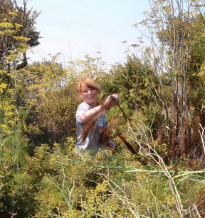
Near the mouth of Schoolhouse Creek, we kept invasives like this fennel from taking over large areas.
Scroll down for a two-minute slide show of our work at the mouth of Schoolhouse Creek..